During Google I/O conference last year, the tech giant introduced a new Augmented Reality (AR) navigation feature for Google Maps. The feature was one of the biggest announcements which commanded lots of attention at the 2018 keynote event. There are indications that the AR navigation feature will soon be available on Google Maps. 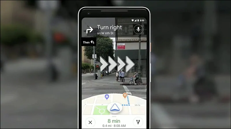
Google recently granted US tabloid, The Wall Street Journal early access to the AR mode feature where it had the opportunity to test the capabilities of the new feature. According to WSJ, the Maps app has a dedicated virtual button that switches on the AR mode. This opens up the camera and starts analysing your surroundings using Street View data. The app then superimposes arrows on to the real world to show where you have to head next. The feature also gets activated if you hold your phone upright for the camera to capture the real world. The feature overlays arrows, landmarks, maps, and possibly even an animated creature to show the way in a camera view that is displaying the actual environment around the users. WSJ also noted that Google Maps repeatedly displays a message that reads, “For your safety, keep your phone down while you walk”. It reportedly also advises users to be alert while walking, as using the feature could be distracting, and lead to accidents.
Read Also: Snapdragon 712 explained by Qualcomm: It’s about enhanced Gaming performance
The feature that has been under testing since it was first announced, will soon be released to a few local guides who are essentially advanced Google Maps users. This doesn’t mean the feature will be available to the public soon as the company indicates that the commercial release will only happen when it is completely satisfied that it’s ready.
(source)


