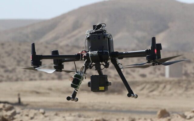
Drones usually utilise waypoint GPS to orient themselves which helps keep them stable while in flight, allowing pilots to hover and to make sure they don’t fly above the 400-foot ceiling required by regulators in countries like the US. Also unmanned droneds rely on GPS network for navigation. But GPS network may experience some down time for several reasons. Thus, in areas where there is no GPS, Israeli startup Sightec has come out with a technology which could help in navigation.
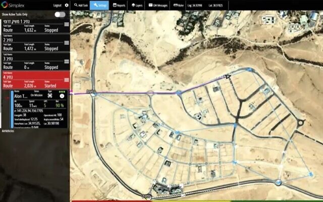
The company disclosed (via) today that it has been able to deploy the technology to fly a civilian drone to its destination in an area without GPS. The feat, a “worldwide first”, was carried out in a flight to an area beyond the experimenters’ line of sight, using computer vision and artificial intelligence technologies.
Sightec CEO roy Samuel sees the success of the test as an important milestone towards the approval of drone delivery operations in Israel. The test flight was actually a demonstration meant for the drone delivery pilot program operated by Israel’s Ministry of Transport (MOT), Ayalon Highways, the Civil Aviation Authority of Israel (CAAI), and Israel Innovation Authority, for testing and demonstrating drone technologies in managed airspace.
Sightec developed a software, dubbed NavSight, that can be deployed on any off-the shelf drone that has a camera onboard. The software utilses the cameras as smart affordable sensors that enable the drone to “see and understand its surroundings” like the human pilot by using video processing technology to help the drone identify its location in real-time.
How it works is that the route is pre-programmed into the drone before the flight with the intent to use GPS. But if GPS fails, the camera turns on automatically and acts as a sensor. In this way, the drone is able to visualize its surroundings in real-time, matching what it sees with a map and pinpoint its own location, both in day and night missions. The technology is able to detect and classify ground and aerial objects, as well as perform 3D mapping, to fully understand its environment. The unmanned aerial vehicle (UAV) is then able either to land safely in emergency mode or get to its final location without the use of the GPS or a human pilot.
RELATED;
- Sony Airpeak drone designed for filmmaking showcased at CES 2021
- LS-MIN Mini Drone Quadcopter available for just $20.99 at Banggood
- DJI FPV Combo drone appears in unboxing video ahead of launch; full specs leaked too


